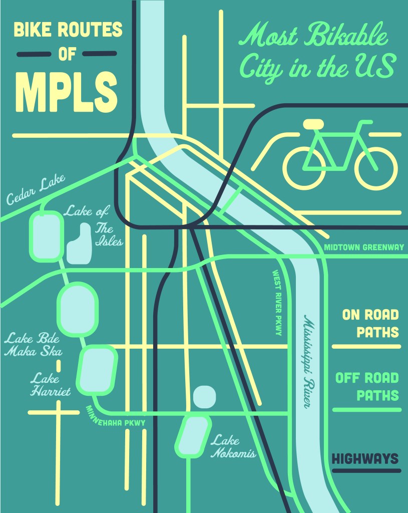
For this project, I wanted to try creating some illustrated maps: One in Illustrator, with a more real-world design based approach, and one in Photoshop, that was more decorative and hand drawn.
I wanted to try creating a map of a real place that works as both a map but also a poster, so in this piece I had to balance aesthetics and function as I worked, while also considering aspects like typography, composition, and readability. I am very happy with how my map of Minneapolis turned out, and I would love to create more of these posters in the future now that I understand how to do it!
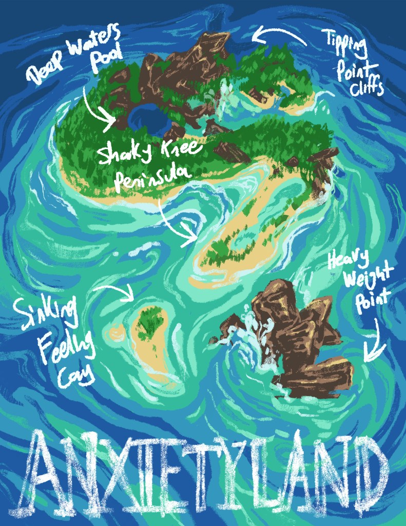
For my next map, I wanted to create something that didn’t refer to a real place, but instead explored mapping a fictional place: Anxietyland! This was an exploration into themes of the body, mental health, design, and illustration, and I had a lot of fun doing it! I learned a lot about hand drawn type and the crossroads of design and illustration.